Loading
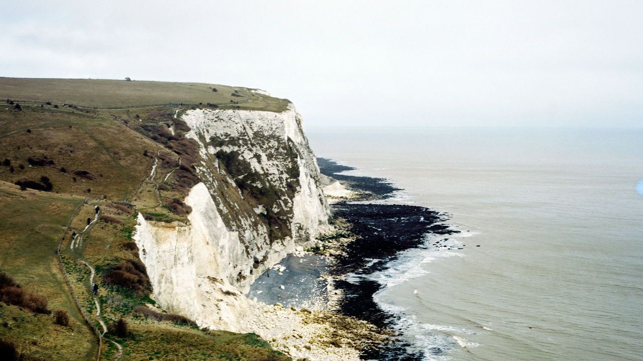
YOU WILLYour browser does not support the element.By Catherine Nixey, Britain correspondent, The Economist walk past Pevensey, where William the Conqueror landed, and Margate, where the Spanish Armada did not. You will walk past Plymouth, from where the famously set sail, and Southampton, from where the infamously did. You will walk past places made famous in poetry and song: past Lyme Regis, where Mary Anning sold seashells on the seashore, past Scarborough Fair, and past the blue birds over the white cliffs of Dover. You will walk along a “footpath through British history”, says David Abulafia, a professor of history at Cambridge University, and its “relationship with the sea”.Britain is an island nation. And soon it will be possible to walk all the way round that island, because the King Charles III England Coast Path, as it is formally known, will open. (Wales already has a coastal path, and Scottish rules enshrine the freedom to roam, including along the coast.) The English path has been long awaited: the campaign for it began in 2004. It is also long. Its 2,700 miles will make it the longest continuous coastal path in the world. Neil Constable, national adviser at Natural England, which has created the path, hopes that by the end of 2025 it will be possible to arrive at the coast of England, and “turn right or left and follow the national trail as far as you want to go”.Since the 1930s British walkers have campaigned for the right of access to Britain’s beauty spots. The coastline was one area where this was lacking: prior to the creation of the path access was “patchy”, says Kate Conto, a policy officer at the Ramblers’ Association, which began the campaign. Only about two-thirds of the coastline was accessible. Now the whole lot will be. Such a path is, says Robert Macfarlane, professor of English at Cambridge University and author of several books on walking, “truly an epic prospect—it will connect deep pasts and possible futures, birdsong and industrial heritage, river-mouth and lighthouse”.Producing that path has, at times, been tricky. Paths that run alongside Britain’s seas have an irritating tendency to end up under water. In some places the coastal path “keeps falling into the sea”, says Darren Braine, a senior adviser at Natural England. This was not merely a logistical problem. It was also a legal one. In Britain a right of way is defined by a mark on a map. It is defined, in other words, by co-ordinates, not common sense.That means a path remains a right of way, even if the land beneath it crumbles away; even if a sea appears on top of it. Just as the waters to the east of England contain ghostly, fossilised forests from when there was land between Britain and Denmark, they also contain ghostly, submerged footpaths that only fish can use. Which is charming, but rather inconvenient. The new path therefore has “rollback” rights: the right of way will move as the coastline does, so that it is always on land (regardless of where the land may be).The path, which takes in many of the well-known landmarks of the British coast—its abbeys and castles and lighthouses—might seem to delineate historical continuity. In truth, says Professor Abulafia, it will delineate change. Not just because it will encircle a nation that was once a great naval power and is no longer, but because it will pass things that have now gone. Here it will pass Winchelsea, a once-great port that is now inland due to the accumulation of silt. There it will go past Dunwich, an entire town swallowed by the sea. There is, says Professor Abulafia, a “vanished past that links Britain to the sea”. In 2025, with the opening of the coastal path, that past will become a little more visible.